Rain Forecast Punjab Haryana Chandigarh—Respite from Scorching Heat From Thursday-Friday
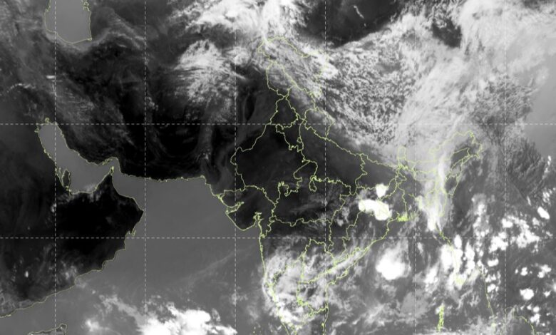
IMD issues special weather bulletin; after severe heatwave with 45–47°C temperatures, a western disturbance triggers widespread rain, thunderstorms, and a 6–8°C temperature drop from May 29–31
North Desk Bureau
Chandigarh, May 27
Rain forecast Punjab Haryana Chandigarh: After a long spell of severe heatwave across Chandigarh, Punjab and Haryana, the India Meteorological Department (IMD) has issued a forecast that will be welcome news for millions: widespread rain, thunderstorms, hailstorms and gusty winds are set to sweep the region.
It starts from Thursday, May 28–with one or two spells of rain. And the next three days from Friday, May 29, it has predicted thundershowers until Sunday, March 31.
The contrast is stark. Central, southern and southwestern Punjab, along with the whole of Haryana, are expected to hover between 45°C and 47°C until Wednesday-Thursday. The rest of Punjab and Chandigarh will sizzle in the 42–45°C range.
Warm nights — with minimum temperatures refusing to dip below 27–30°C — have offered no overnight relief. The stretch of dry, punishing heat has made this one of the more intense pre-monsoon spells in recent memory; Chandigarh touched 44.4°C last week, its hottest since 2012 barring 2024, while Bathinda reached 45.8°C on Tuesday.
Then, from Thursday or Friday, the weather is expected to flip dramatically.
Western disturbance
A fresh western disturbance will affect north-west India from May 28. Under its influence, IMD has forecast light to moderate rainfall at many places in Punjab and Haryana on May 29 and 30, along with thunderstorms, lightning and gusty winds. The weekend will see further activity, with light rain likely at isolated places on May 31 as well.
Special IMD bulletin: Rain forecast Punjab Haryana Chandigarh
The IMD’s special bulletin flags significant hazards alongside the relief. Thundersqualls with wind speeds reaching 70–80 kmph are likely over Punjab, Haryana, Chandigarh and Delhi on May 28 and 29. Isolated hailstorm activity has also been forecast for May 28 and 29. Residents and farmers are advised to stay alert.
The temperature relief will be significant: IMD has projected a fall of 6–8 degrees Celsius over three days once the wet spell sets in, before temperatures edge back up by 2–4 degrees thereafter. Heatwave conditions are expected to start abate in a day or two, according to the bulletin issued on May 26.
Why this change of weather
Rain forecast Punjab Haryana Chandigarh: The meteorological driver behind the change is a fresh western disturbance moving in from the northwest, while an existing trough persists from Punjab to the northeast Arabian Sea across Pakistan. The combination is expected to generate scattered to fairly widespread rainfall across Jammu & Kashmir and Uttarakhand from May 28–30, Himachal Pradesh on May 28–29, and Punjab, Haryana and Chandigarh through the weekend.
For now, authorities in both states have advised residents to stay indoors during peak heat hours between noon and 4 pm, stay hydrated, and avoid unnecessary outdoor exposure through Thursday. The relief, for once, has a date on it: Friday.
ALSO: Gurmeet Ram Rahim Singh Parole: 16th Release, 406 Days Outside Sunaria Prison
LIQUOR LANGAR!: Chandigarh’s Sector 9 Gets a ‘Liquor Langar’ — and a Rude Awakening
Follow North Desk on WhatsApp for the latest from Punjab, Haryana and Himachal Pradesh: https://whatsapp.com/channel/0029Vb7ccdxJENy2H87DBG3E